 Loading... Please wait...
Categories
Shop by Price
Popular Brands
Our Newsletter
- Home
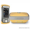
- GPS GNSS SYSTEMS
GPS GNSS SYSTEMS
GPS (Global Positioning System) is a satellite-based navigation system that provides accurate location and time information to users around the globe. Initially developed for military applications, GPS is now widely used in various civilian applications.
How GPS Works
Satellite Constellation
GPS relies on a network of satellites orbiting the Earth, continuously transmitting signals to receivers.
Triangulation
By calculating the distance from at least four satellites, a GPS receiver can determine its precise location.
What is GNSS?
GNSS (Global Navigation Satellite System) encompasses all satellite-based navigation systems, including GPS, GLONASS (Russia), Galileo (EU), and BeiDou (China). GNSS provides global coverage and improved accuracy.
Components of GNSS
Satellites
The backbone of GNSS, providing the signals necessary for positioning.
Ground Control Stations
Monitor and manage satellite operations, ensuring accuracy and reliability.
User Equipment
Devices such as smartphones, vehicles, and dedicated GPS receivers that interpret satellite signals.
Applications of GPS and GNSS
Navigation
Used in vehicles, aircraft, and maritime vessels for route planning and tracking.
Surveying
Essential for land surveying, construction, and mapping applications.
Agriculture
Enables precision farming techniques, improving crop management and efficiency.
Future Trends in GPS and GNSS Technology
Enhanced Accuracy
Advancements in technology are leading to improved accuracy and reliability in positioning data.
Integration with Other Technologies
Combining GNSS with IoT, AI, and other technologies for smarter applications.
Conclusion
GPS and GNSS systems play a crucial role in modern navigation and positioning. Understanding their functions and applications is vital for leveraging their capabilities across various industries.
Current Top Sellers
-
1

-
2

-
3

-
4
 Popular Products
-
 $3,150.00
-
 $6,300.00
-
 $5,250.00
-
 $6,300.00
-
 $5,250.00
New Products
-
$3,150.00
-
$6,300.00
-
$5,250.00
-
$6,300.00
-
$5,250.00